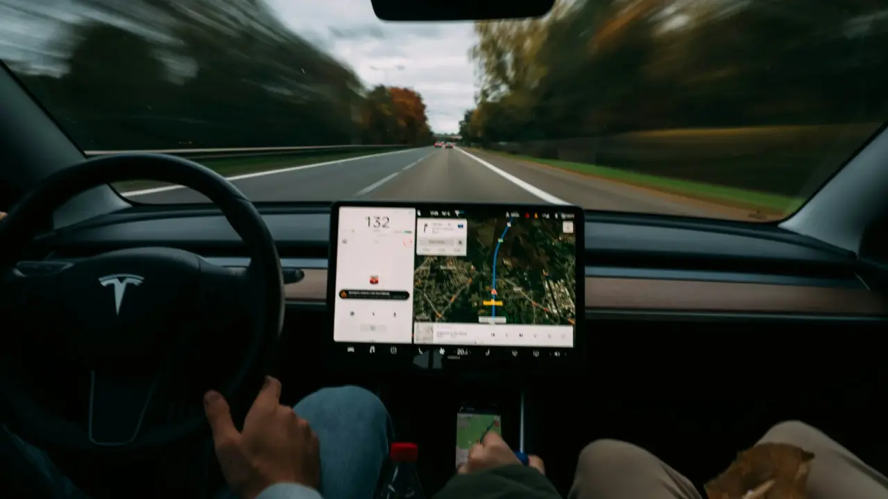
Most of the time, the Global Positioning System works so smoothly that people hardly think about it. Drivers get directions right away from navigation apps. Ride-hailing services quickly find the closest driver.
Packages travel across cities and countries while customers track their locations on their phones. All these everyday conveniences rely on a technology system orbiting far above Earth.
GPS is used all over the world, but most people don’t notice it in their daily lives. It began as a military navigation project during the Cold War and has grown into a key part of global infrastructure.
GPS now supports transportation, telecommunications, finance, agriculture, disaster response, and many digital services. Simply put, GPS tells us our location and the time, helping to organize much of modern life.
NASA shared that GPS is a satellite-based radio navigation system owned by the United States government and operated by the U.S. Space Force, providing users with positioning, navigation, and timing (PNT) services.
Those services allow receivers anywhere on Earth to determine their location, speed, and precise time using signals transmitted by satellites orbiting the planet.
The Origins of GPS
GPS began in the early 1970s, when the United States Department of Defense started working on a satellite navigation system that could give accurate location information anywhere on Earth. The main goal was to help military forces navigate and coordinate without depending on ground-based systems that might be destroyed during conflicts.
Eventually, people saw that GPS could be useful for civilians too. As GPS.gov explains, the system became a free, open, and dependable utility that made possible hundreds of applications affecting every aspect of modern life. By the early 2000s, GPS was used in many industries, including aviation, shipping, emergency response, and agriculture.
Today, billions of devices around the world use GPS. Smartphones, airplane navigation systems, shipping fleets, surveying tools, and farm equipment all depend on GPS signals to find their position and coordinate movement.
How GPS Works: A System Built on Time
GPS works on a simple idea: if you know where the satellites are and how long their signals take to reach you, you can figure out your location on Earth.
NASA says GPS includes 30+ navigation satellites circling Earth, each sending out signals that receivers can pick up. A GPS receiver measures how long it takes for a signal to arrive from a satellite and uses that to figure out the distance. By finding its distance from several satellites, the receiver can work out its position.
This method is called trilateration. Each satellite sends a signal with two important details: the time it was sent and the satellite’s location in space. Since radio waves travel at the speed of light, a receiver can figure out how far away the satellite is by comparing when the signal was sent to when it was received.
But one satellite isn’t enough to find a full position. A receiver needs signals from at least four satellites to figure out latitude, longitude, altitude, and correct its clock.
The European Space Agency explains that by combining signals from at least four satellites, the receiver can determine its three-dimensional position and time.
In short, GPS is more than just a way to find your position. It’s also a timing system that uses very precise clocks to measure how long signals take to travel.
The Satellites Above Us
The group of GPS satellites is the core of the whole system. These satellites orbit Earth about 20,200 kilometers above us, in what’s called medium Earth orbit. They are spaced out so that receivers anywhere on Earth can pick up signals from several satellites at once.
According to the Federal Aviation Administration, there are now more than 30 working satellites in the GPS system, giving coverage all over the world. These satellites constantly send out navigation signals that can be picked up by everything from airplane systems to smartphones.
Each satellite has very accurate atomic clocks that keep time extremely well. These clocks are important because even a small timing mistake can lead to big errors in finding a position. If the timing is off by just one microsecond, the location could be wrong by hundreds of meters.
That’s why ground control stations always monitor GPS satellites, update their positions, and make sure their clocks stay in sync.
The Devices That Receive GPS Signals
The third part of GPS is the user segment, which includes the receivers that read satellite signals and turn them into useful location information.
These receivers include everything from special navigation tools used in planes and ships to tiny chips inside smartphones and wearables. Modern receivers are very advanced and can process signals from several satellite systems at the same time.
The Federal Aviation Administration notes that GPS is now part of a broader Global Navigation Satellite Systems (GNSS) ecosystem that includes other constellations such as Europe’s Galileo, Russia’s GLONASS, and China’s BeiDou. Many modern devices combine signals from these systems to improve accuracy and reliability.
The Many Functions of GPS
Although most people associate GPS with driving directions, its functions extend far beyond navigation.
In aviation, GPS has transformed how aircraft navigate. The FAA explains that satellite navigation enables aircraft to follow precise routes and allows more efficient flight paths, reducing delays and fuel consumption while improving safety.
Emergency services also rely heavily on GPS technology. GPS.gov states that the system has become an integral part of modern emergency response systems, helping responders locate incidents, coordinate rescue operations, and guide emergency vehicles quickly to the correct location.
Agriculture represents another major application. Precision farming technologies use GPS to map fields, guide tractors, and monitor crop conditions. According to GPS.gov, farmers use GPS-based tools to map field boundaries, roads, irrigation systems, and crop problem areas such as weeds or disease, enabling more efficient and environmentally sustainable farming practices.
Another crucial function of GPS is time synchronization. The National Institute of Standards and Technology explains that GPS signals are widely used as a reference for time synchronization and frequency calibration, supporting telecommunications networks, financial systems, and power grids.
So, GPS works as a global clock in addition to being a navigation system.
The Advantages of GPS
One of the best things about GPS is that it works everywhere. Unlike older navigation systems that need local equipment, GPS signals reach the whole planet.
The FAA notes that GPS provides accurate positioning information anywhere in the world and in all weather conditions, making it invaluable for transportation systems operating across international borders.
Another big advantage is accuracy. GPS can usually find a user’s location within a few meters, and advanced systems with extra correction signals can be accurate to just a few centimeters.
NASA’s educational materials emphasize that once a receiver calculates its distance from multiple satellites, it can determine its exact position with remarkable precision.
GPS is also flexible. The same signal can be used for many things, from helping people find their way on a phone to guiding airplanes.
The Limitations and Risks of GPS
Despite its benefits, GPS has limitations.
One problem is that GPS signals are weak by the time they reach Earth, so buildings, mountains, and thick forests can block them.
The GPS World explains that environments such as urban canyons can degrade GPS accuracy because signals may reflect off buildings or become blocked entirely.
Another issue is that GPS signals can be interfered with. Devices can jam the signals, or attackers can send fake signals to trick receivers.
Because of these risks, researchers and governments are looking for backup navigation technologies and ways to make satellite navigation more secure.
Why GPS Remains Essential in the Modern World
GPS is now so much a part of daily life that many industries couldn’t work without it. Transportation, supply chains, telecom networks, financial markets, and emergency services all depend on accurate location and timing.
What’s amazing about GPS is that most people never notice how complex it is. Satellites orbit far above Earth, atomic clocks keep time to billionths of a second, and advanced math all work together to find the location of a device in your pocket.
GPS started as a military navigation experiment, but now it’s one of the most important technologies in the world. As things like self-driving cars, smart cities, and advanced robots develop, GPS and other satellite navigation systems will become even more important.
In the end, GPS is more than just a navigation tool. It quietly reminds us that the technology shaping our daily lives often works high above us.